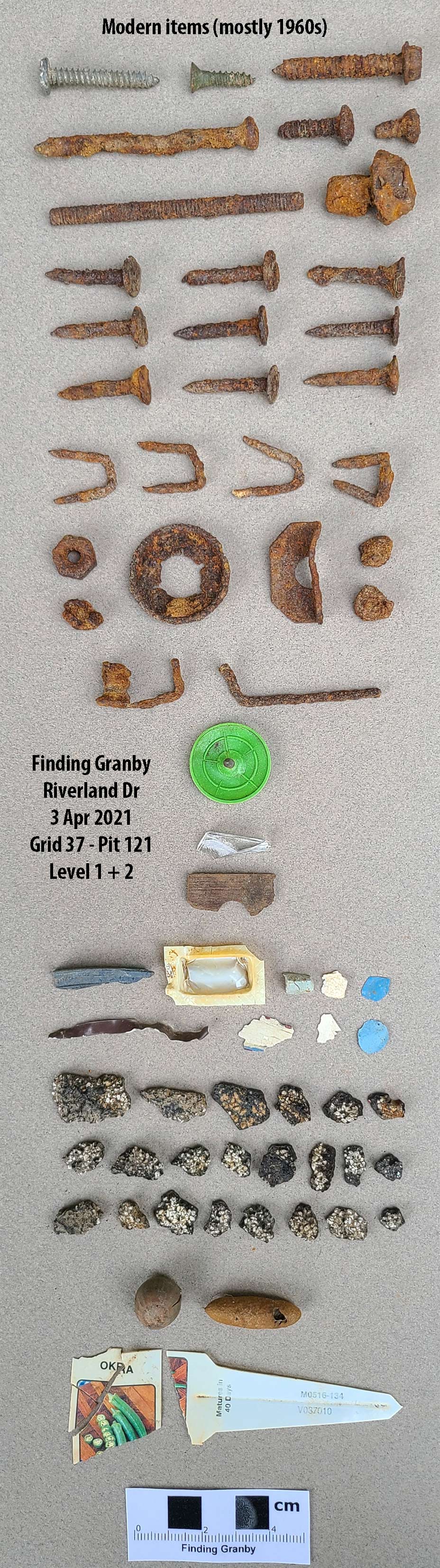
Pit 121: Level 1
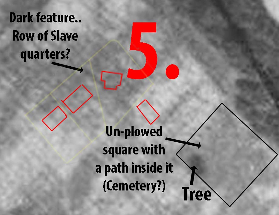
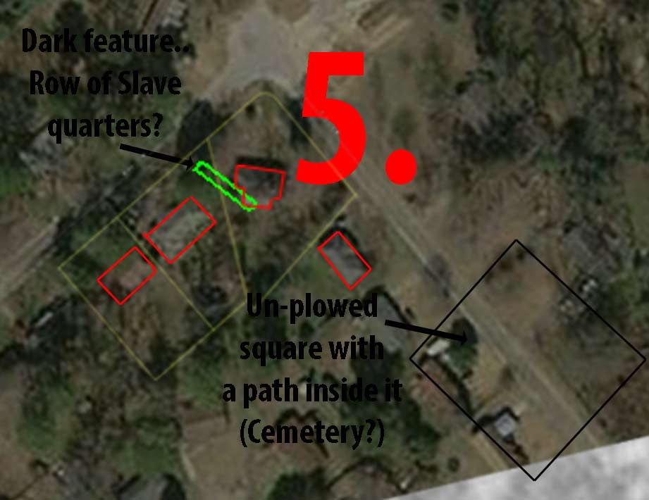
Completed on April 3, 2021 by Jocelyn and DC Locke, Odess and David Brinkman. Recent work was directed at aligning the 1939 aerial photo of the area with today's view. Early in the Granby dig, State Archaeologist, Dr. Jonathan Leader recommended that I look for an old aerial photo, knowing that this location was farmland. A photo of a newly plowed farm may show areas of human habitation. Only humans burn fires. They did it so much during the 18th and 19th centuries that it changed the color of the soil where there was high human activity. Sure enough, the discovery of a 1939 aerial photo showed the entire area of Riverland Park to be newly plowed, and the dark ground spots have proven to be the areas where we find the most artifacts. And in those areas, as we dig, the artifacts stop when the dirt takes on a light color. The recent work I did was to more closely align the 1939 with today's aerial photo. When I was done, the darkest area on our dig property was an area we had not dug. Looking closer, this dark area was a distinct line of what looked like three small L-shaped buildings. Each one would have been 150 square feet. As it turns out, in the 18th century, slave quarters had an average size of 140 square feet. From the 1800 census, we know that the owners of the Granby property (that we are digging) had ten slaves. These slaves would have lived somewhere on the property. Was this the location? Pit 121 would be the first of a line of pits that would attempt to intersect with this dark feature. We first did a test pit (about one-foot square) in the corner of today's house and back of the carport. We called this soil probe 11. It became quickly apparent that the 1960s construction of the house created a one-foot deep excavation for the house and carport foundation. The outside area of this old digging, where we did the test pit, was then filled in and only contained modern items. We then moved further out and repeated the same process. This time, we would make one of the biggest Granby finds, and we quickly expanded the test hole into a full pit. The first level was very disturbed (possibly from the dirt kicked out from the carport foundation dig.) We decided to skip the leveling of level one and go straight into level two. See this next level for that amazing find.
Pit 121: Level 1 produced: Many items from the 1960s and a few newer.
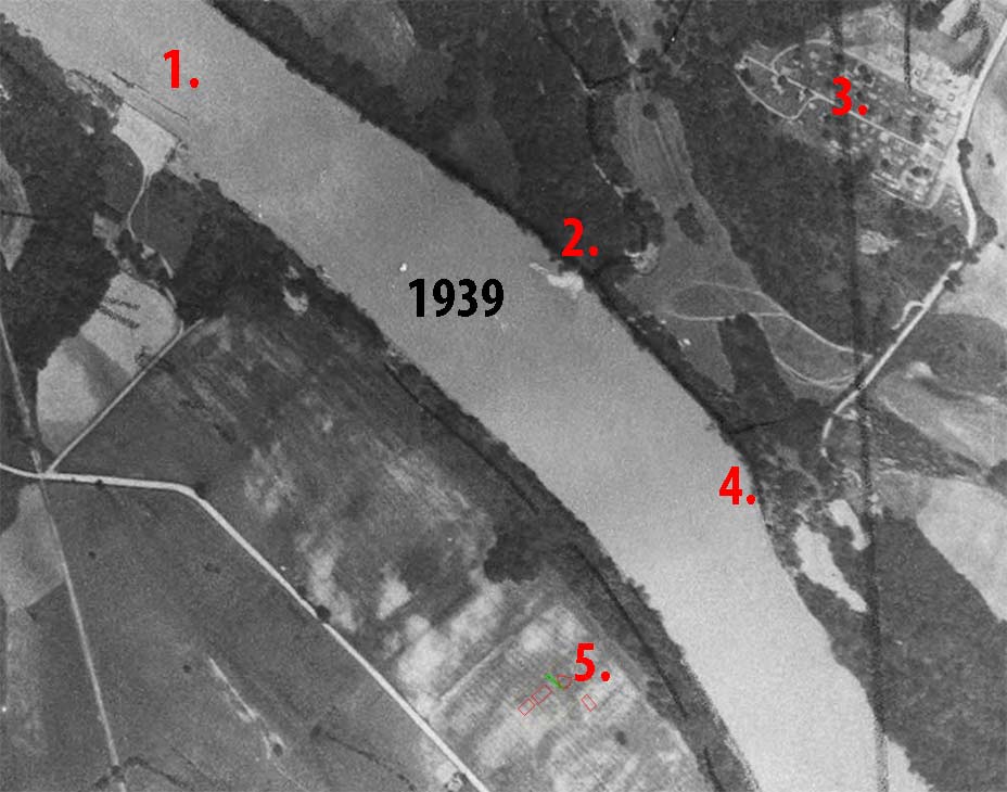
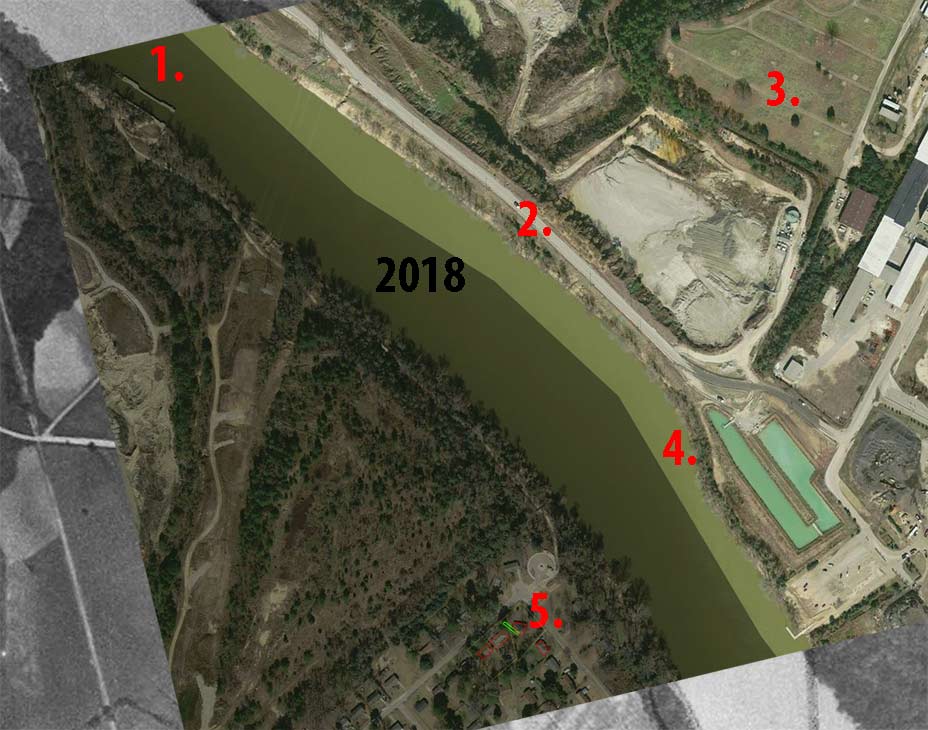
Below is the work to align the old and new aerials to pinpoint the possible slave quarters feature.
I used four common landmarks (from both 1939 and 2018).
#1 is the Granby Locks.
#2 are rock remains from a 1939 drainage.
#3 is a cemetery on the other side of the river.
#4 is the distinct narrowing of the Congaree River.
#5 is our dig site/house and the adjacent neighbors.