Fort Congaree II - 18th Century Evidence
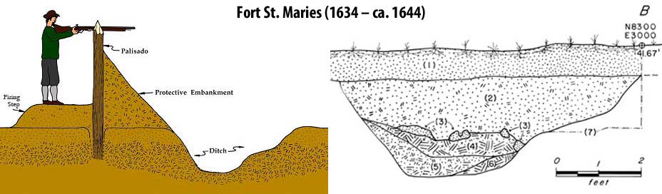
James Campbell built Fort Congaree II in 1748. Campbell married Elizabeth Taylor who was of the first generation of Taylors born in the area. She was the sister of Revolutionary War hero Thomas Taylor. James lived a long life and died in Granby in 1801. Fortunately for us, the following documentation from 1748 confirms the Fort had a ditch (moat) around it which was probably about 6 or 7 feet wide and 2 to 3 feet deep.
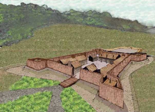
Below is a drawing showing what the moat/ditch looked like at Fort St. Maries. Fort Congaree II may have been similar.
So, if we are looking for signs, we should keep these in mind.
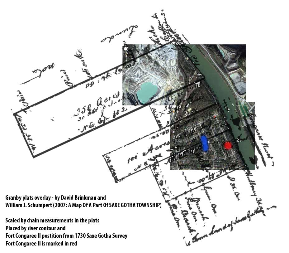
As well as the evidence from a 1939 aerial and Colonial period plats,
we also have location evidence from an 18th century survey and map.
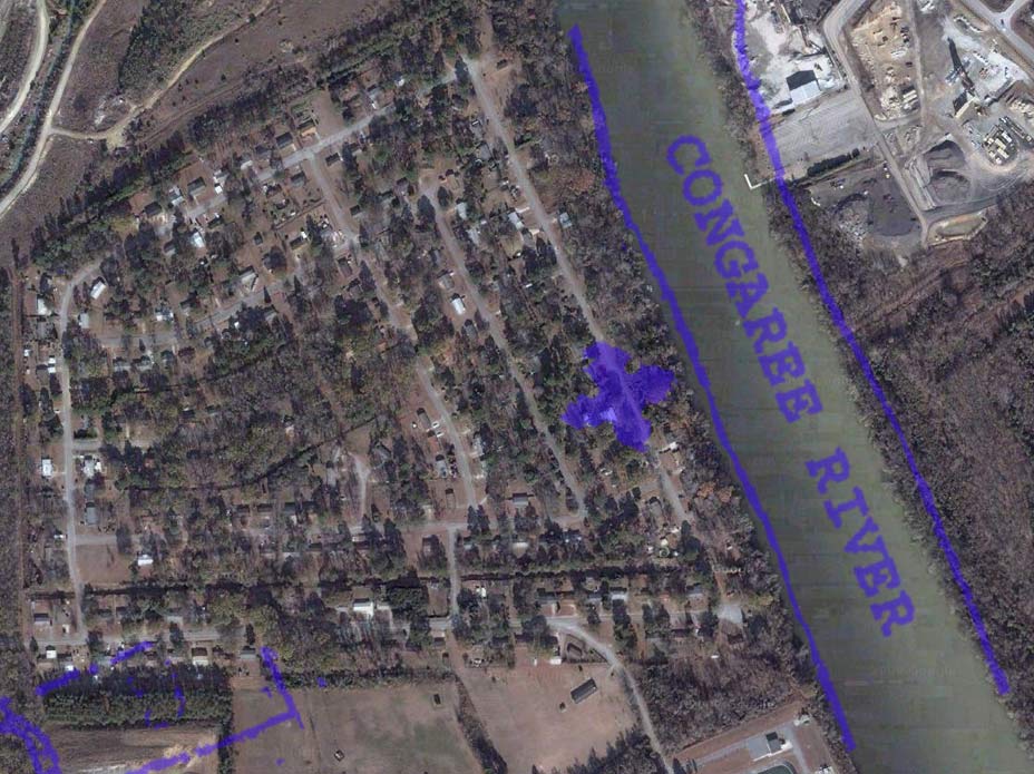
Below is an overlay (on today's aerial photo) of the Fort Congaree II
position from a 1789 Taylor family map of Granby.
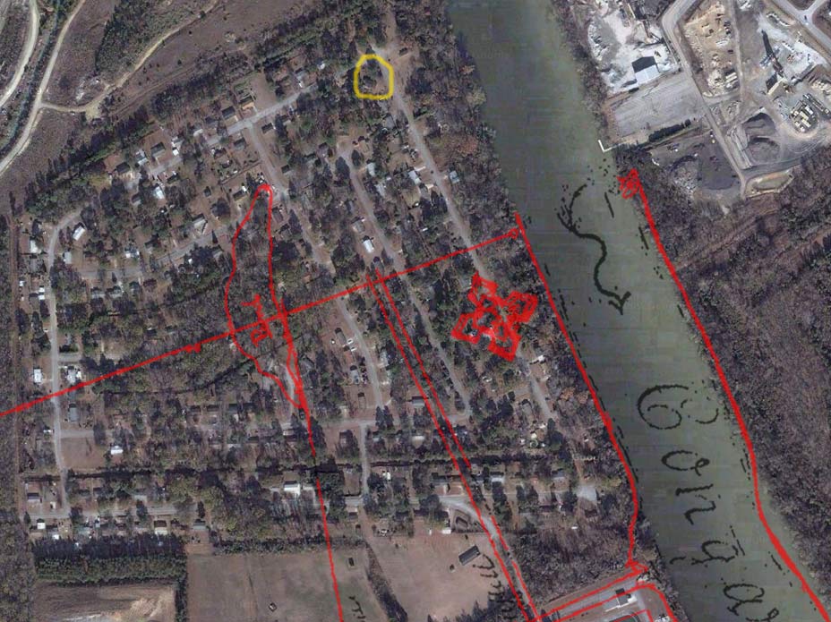
Below is an overlay (on today's aerial photo) of the Fort Congaree
II position from an 18th century survey of the Saxe Gotha Township. The
yellow circle is our Granby dig site. Notice the pond that is drawn
from the old survey. Today, this is the area of the Riverland Park
neighborhood that is prone to flooding as it is about 4 feet lower in
elevation than the rest of the neighborhood. One of the Colonial plats
also shows this pond in the same position. We now have 5 pieces of
evidence (18th century plat, map, and survey. Early 20th century aerial
photos and the testimony of an early 20th century historian.)that all
place the fort in the same position. This is all circumstantial
evidence. The next step is to go in and find physical evidence to prove
the case.
From: Common Journals: January 19, 1748 - June 29, 1748:
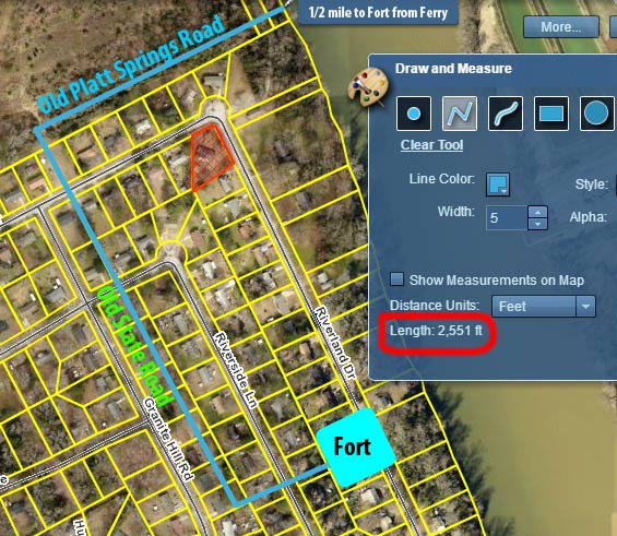
"9 Feb 1749/50: Friday petitioned again: "there is a very proper Place for a ferry, about half a mile above the said Fort, and on the road that leads to the Catawba nation, where Martin Fridig, Miller at the Congaree, has on his own Lands on the west side of the said River Convenient Houses for a Ferriman, and has also a large Canoo, and is building a Flat for the carrying over Horses and Loads. He prays to please grant Liberty to the said Martin Fridig to keep a Ferry at the said place." The petition was tabled again. However, the license for Friday's Ferry was finally issued by an Act of 11 May 1754."
Below is a modern day aerial showing our expected fort site and the known locations of the Old State Road and the road to Friday's Ferry. Using the Lexington County GIS system to make the measurement, this route from the ferry to the fort is exactly 1/2 a mile.
 Above, SCIAA drawing of Fort Prince George based on Archaeological work. This fort was built just a few years after Fort Congaree II and may have been very similar. |