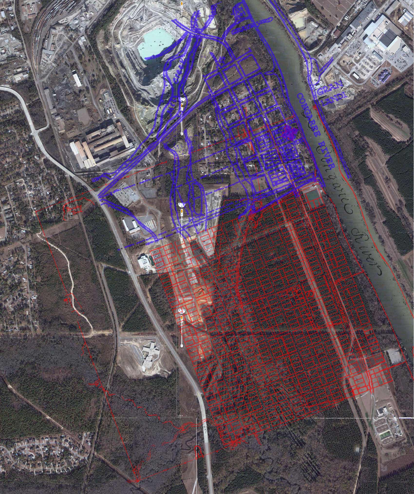
Granby - Saxe Gotha Overlay
David Brinkman 5/1/2010Important points:
1.
The Saxe Gotha overlay (Red) is scaled based on the chain measurements
on the survey and the alignment is done with the pond and canal in the
northern
part of the survey and the outline of the Congaree river on the east
side of the survey. It might be good to do another overlay whle
aligning with the creeks in the south-western part of the survey.
2. The Granby map (overlay in Blue) did not have a scale. It was re-sized so that the town block matched the same size as the blocks in the Saxe survey and then aligned with the same pond and canal in the Saxe survey (after overlaying the Saxe survey). The resize appears to be a good assumption because the symbol for the fort ends up having the exact same size in both surveys. Also, notice how the old Platt Springs Road lines up exactly with the road today. I believe this was the ferry road which lines up nicely with the recently located remains of the ferry ramp.
3. Another interesting point is that the pond shown in the northern portion of the Saxe survey matches the low lying area of the Riverland Park neighborhood.
4. I was not really trying to align the fort symbols of the Saxe Survey and the Granby map but, as you can see, they end up with the exact same position and size.
5. The river front quad of the fort is located on an undeveloped lot in the Riverland Park neighborhood.
The image below is large and you may need to use the scroll bars to view the full image. Click on the "faint overlay" link (below) to lower the opacity of the overlay.
Images of the Granby map and Saxe Gotha Town survey are also include below the following overlay.
Click here for strong overlay
Click here for faint overlay
 Click here for strong overlay
Click here for faint overlay
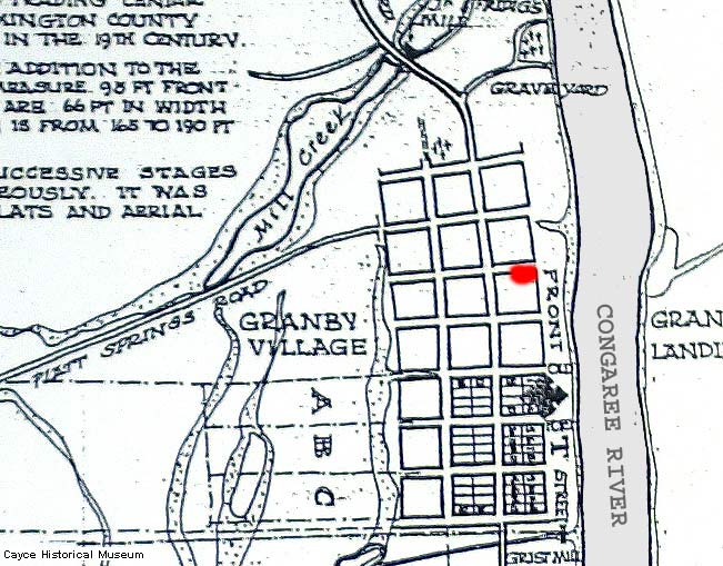
Below is the old Granby Map
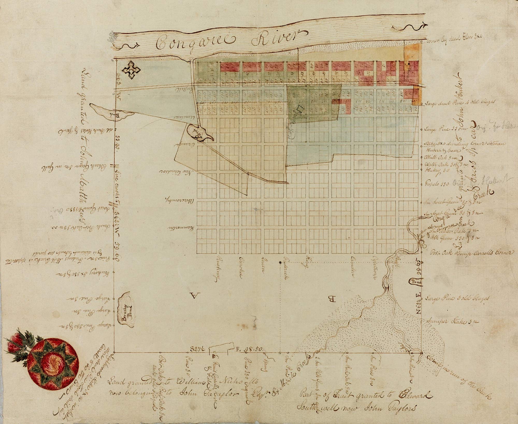
Below is the old Saxe Gotha Survey
1798 Court Case involing a 1769 Survey of the land of the Saxe Gotha Town
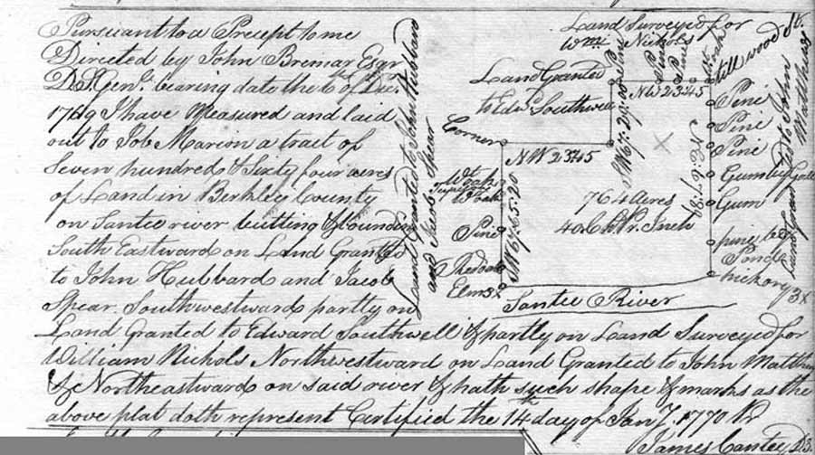
Old court cases can contain lots of good information for Historians. The following PDF file covers a 1798 court case where there has been an attempt to reclaim the town property claiming it was never really given out by the King. The court accepts the orginal 1732 survey (called an "ancient plat" by the 1798 court) as valid evidence. Click on the following link to view the recorded court case. Don't let "Berkley County" and "Santee River" confuse you. In 1798, all of today's Lexington County was part of Berkley County and the Congaree River was often called the Santee River.
Reports of cases argued and determined in the superior courts of law in the State of South Carolina: Volume 2
By Elihu Hall BayThe above court case refers to the following 1769 plat. Notice that the land owners to the north and south are the same as the ones in the 1732 survey. The south-west corner of the 1732 survey has a dotted-line marking an area which is not included in the 1769 plat.
SCDAH: S213184: Colonial Plat Books (Copy Series)
MARION, JOB, PLAT FOR 764 ACRES IN BERKLEY COUNTY.